
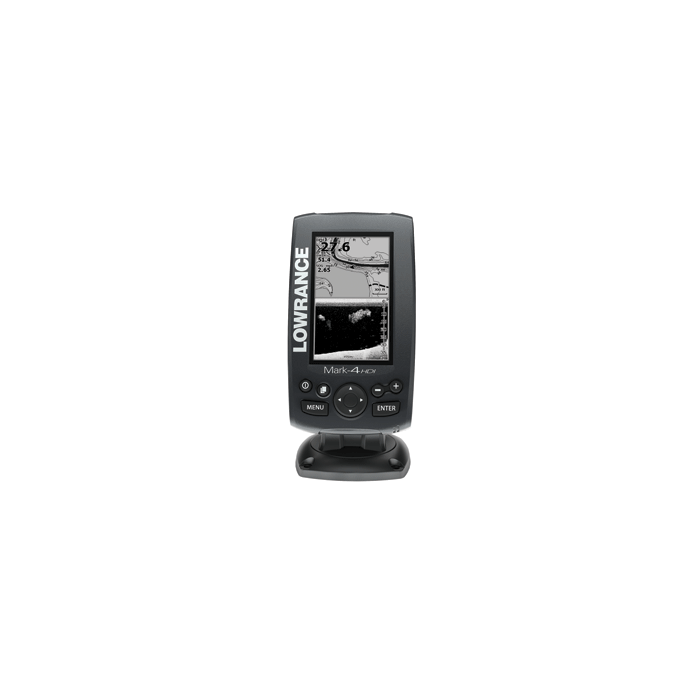
Lowrance Mark-4 HDI Chartplotter/Fishfinder
$179.00
Out of stock
SKU
JMS257514
Lowrance Mark-4 HDI Chartplotter/Fishfinder
Lowrance Mark-4 HDI
FishFinder/Chartplotter
The easy-to-use 4.3" fishfinder/chartplotter w/ Hybrid Dual Imaging™
that combines Broadband Sounder™ with DownScan Imaging™
technology (with appropriate transducer), a super-bright, LED-backlit grayscale display, built-in GPS antenna and high-definition mapping.
Key Features:
Specifications:
Overview
Sonar
Technical/Environmental
Power
GPS Navigation
Basemap = Yes | Card Format = Micro SD | Cartography - Preloaded = No | Cartography Brand = Navionics | Cartography Type = Gold/HotMaps Premium | Frequency = 83/200-50/200-455/800 | Included Transducer = No | Internal/External Antenna = Internal | Resolution (VxH) = 480 x 272 | Screen Size = 4.3" | Screen Type = Grayscale | Speed/Temp = Temp Only | Touchscreen = No | Transducer Type = Not Included | Waterproof Rating = Waterproof | Watts RMS - Max = 250W | Waypoints/Routes = 3000/100 | Weather Capable = No
Category: Marine Navigation & Equipment | GPS - Fishfinder Combos
Manufacturer Part Number: 000-11298-001
FishFinder/Chartplotter
The easy-to-use 4.3" fishfinder/chartplotter w/ Hybrid Dual Imaging™
that combines Broadband Sounder™ with DownScan Imaging™
technology (with appropriate transducer), a super-bright, LED-backlit grayscale display, built-in GPS antenna and high-definition mapping.
Key Features:
- Lowrance-exclusive, brilliant, high-resolution, 4.3" , LED-backlit
grayscale display - Exclusive Hybrid Dual Imaging™ (HDI) - Broadband Sounder plus
DownScan Imaging™ -- the power of two award-winning technologies
combined to provide the best possible view beneath your boat with appropriate transducer - Highly accurate, built-in GPS antenna plus a detailed U.S. map featuring
more than 3,000 lakes and rivers and coastal contours to 1,000' - Optional chart upgrades include Lake Insight™ and Nautic
Insight™ PRO and HD, Navionics® Gold and HotMaps® Premium,
Fishing Hotspots® PRO - Create your own map from real sonar data that you record with Insight
Genesis™ - DownScan Overlay™ technology overlays DownScan Imaging onto
Broadband Sounder - Advanced Signal Processing (ASP) reduces the need to manually adjust
settings to see fish, structure and bottom detail more clearly - TrackBack™ to review recorded sonar history including structure,
transitions or fish targets, then pinpoint locations with a waypoint - Easy-to-use page selector menu with quick access to all features using
one-thumb operation - Multi-Window Display lets you quickly and easily choose from pre-set
page layouts -- including a three-panel view with chart, Broadband Sounder
and DownScan Imaging - NMEA Output: NMEA 0183
- Supported by Lowrance Advantage Service program
Specifications:
Overview
- Display Size: 4.3"/10.92cm
- Resolution: 480 x 272
- Backlighting: 11-Level LED
- Power Output: RMS (PTP): Max 250W RMS, 30,000W Peak to Peak (analog
equivalent) - Languages: 30
- HDI Operating Frequencies: 83/200 kHz or 50/200 + 455/800 kHz
- Operating Voltage: 12VDC (10-17VDC min-max)
- Media Port: One (1) high-capacity microSD slot
- Warranty: One year
Sonar
- Depth Alarm: Yes
- Sonar Frequencies: 83/200 or 50/200 + 455/800
- Shallow Alarm: Yes
- Temperature Readings: Yes
- Transducer Type: Multiple selections Lowrance and Airmar®
- Max Depth Per Transducer Type
- DownScan Imaging™: Max 300' / 91M @ 455/800 KHz
- Broadband Sounder™: Max 750' / 229M @ 83/200 kHz
- Broadband Sounder™: Max 2000' / 610M @ 50/200 kHz
Technical/Environmental
- Waterproof Standard/Rating: IPx7
- Product Width: 3.8"\ 96mm
- Product Depth: 2.2" \ 56mm
- Product Height: 6.6" \ 168mm (7.5" \ 189mm w/bracket)
Power
- Power Supply (Supply Voltage): 12 VDC (10-17 VDC min-max)
GPS Navigation
- Navigation: Routes: 100
- Navigation: Waypoint Storage: 3,000
- GPS Antenna Type: Internal high-sensitivity WAAS + EGNOS + MSAS
(optional external antenna) - Plot Trails: Up to 100 trails - up to 10,000 points / trail
- GPS Alarms: Yes
- Background Mapping: US Background map with over 3,000 enhanced lake maps
with depth contour and shoreline detail, plus coastal depth
contours/shoreline detail and spot depth soundings to 1,000'/305M - Mapping Options: Lake Insight™ and Nautic Insight™ PRO and HD,
Navionics® Gold and HotMaps® Premium, Fishing Hotspots®PRO
Basemap = Yes | Card Format = Micro SD | Cartography - Preloaded = No | Cartography Brand = Navionics | Cartography Type = Gold/HotMaps Premium | Frequency = 83/200-50/200-455/800 | Included Transducer = No | Internal/External Antenna = Internal | Resolution (VxH) = 480 x 272 | Screen Size = 4.3" | Screen Type = Grayscale | Speed/Temp = Temp Only | Touchscreen = No | Transducer Type = Not Included | Waterproof Rating = Waterproof | Watts RMS - Max = 250W | Waypoints/Routes = 3000/100 | Weather Capable = No
Category: Marine Navigation & Equipment | GPS - Fishfinder Combos
Manufacturer Part Number: 000-11298-001
| UPC Code | 9420024128343 |
|---|---|
| Manufacturer Part Number | 000-11298-001 |
| Manufacturer | Lowrance |
Write Your Own Review