
Garmin VUS036R Inland Rivers Bluechart G2 Vision
$321.42
Out of stock
SKU
JMS170709
GARMIN VUS036R INLAND RIVERS BLUECHART G2 VISION
VUS036R Covers:
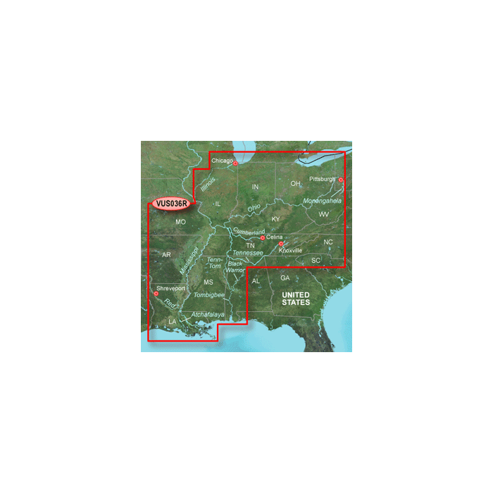
Detailed main channel coverage of the major rivers of the interior of the United States as part of the Great Circle Route. Coverage includes the Ohio, Illinois, Tombigbee, Black Warrior, and Atchafalaya Rivers in their entirety, as well as the Tenn-Tom Waterway in full. Coverage also features the Mississippi River from its junction with the Illinois above St. Louis, MO to the Delta; the Tennessee River from Knoxville, TN to the Ohio; the Cumberland River from Celina, TN to the Ohio; the Monongahela River from Fairmont, WV to the Ohio; and the Red River from Shreveport, LA to the Mississippi. General coverage of the Gulf of Mexico from Port Arthur, TX to Pensacola, FL; and the southern portion of Lake Michigan from Waukegan, IL to South Haven, MI.
Detailed main channel coverage of the major rivers of the interior of the United States as part of the Great Circle Route. Coverage includes the Ohio, Illinois, Tombigbee, Black Warrior, and Atchafalaya Rivers in their entirety, as well as the Tenn-Tom Waterway in full. Coverage also features the Mississippi River from its junction with the Illinois above St. Louis, MO to the Delta; the Tennessee River from Knoxville, TN to the Ohio; the Cumberland River from Celina, TN to the Ohio; the Monongahela River from Fairmont, WV to the Ohio; and the Red River from Shreveport, LA to the Mississippi. General coverage of the Gulf of Mexico from Port Arthur, TX to Pensacola, FL; and the southern portion of Lake Michigan from Waukegan, IL to South Haven, MI.
| UPC Code | 753759069179 |
|---|---|
| Manufacturer Part Number | 010-C0737-00 |
| Manufacturer | Garmin |
Write Your Own Review