
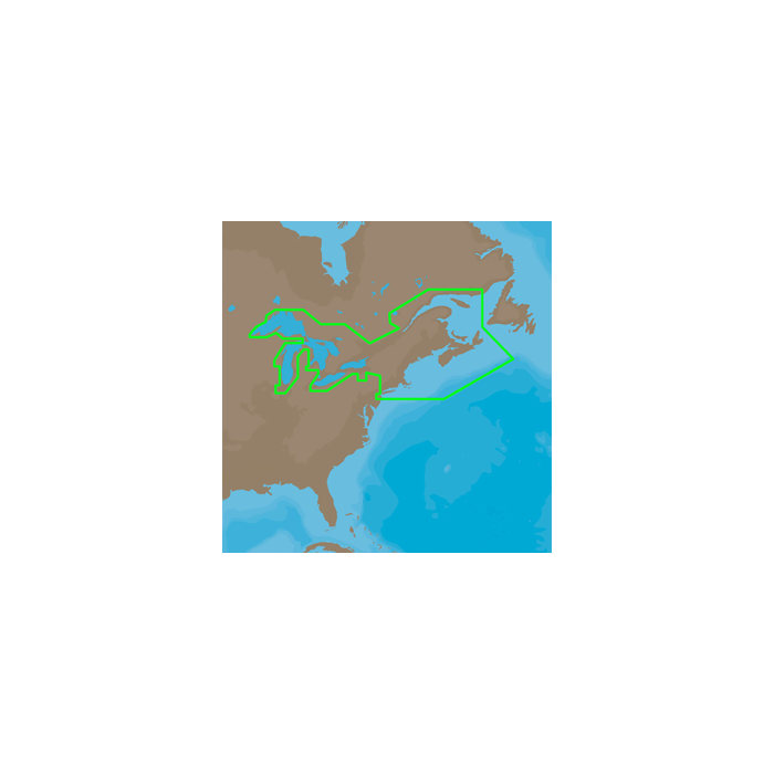
C-Map 4D Na-D026 Max Great Lakes Northeast Coast & Appr NA-D026-MX
$199.00
Out of stock
SKU
JMS208385
C-MAP 4D NA-D026 - Great Lakes, Northeast Coast & The Maritimes - MAX Content
NA-D026 - Great Lakes and the Maritimes
Coverage of the Great Lakes, St. Lawrence River and Northeast United States.Coverage of the Great Lakes also includes Fox River and Lake Winnebago, Lake St. Clair,Rideau Canal, Ottawa River and the Trent-Severn Waterway. Includes all coastal charts for New Brunswick and Nova Scotia in Canada and Maine, New Hampshire, Massachusetts, Connecticut and New York in the U.S. Also included is coverage of the Hudson River and LakeChamplain as well as the Erie Barge Canal.
4D MAX Content
When you choose 4D MAX content you will benefit from the most accurate chart details and all the features of C-Map MAX cartography, such as:
- Guardian Alarm - An extra layer of safety.
When activated, Guardian Alarm performs an automatic forward-scanning check for obstacles. Use the feature as an added backup to alert you should you head toward a potentially harmful object. - Detailed NavAids
- Route Check
- Detailed Marina Charts
- C-Marina Ports Database
- Multi-Language Capability
- Dynamic Tides & Currents
- Photos & Diagrams
- Depths & Land Elevations
- Perspective View
| UPC Code | 686074003620 |
|---|---|
| Manufacturer Part Number | NA-D026-MX |
| Manufacturer | C-Map |
Write Your Own Review